 Hartlepool Sports & Leisure
- Cinemas, Theatres & Dance Halls
- Musicians & Bands
- At the Seaside
- Parks & Gardens
- Caravans & Camping
- Sport
 Hartlepool Transport
- Airfields & Aircraft
- Railways
- Buses & Commercial Vehicles
- Cars & Motorbikes
- The Ferry
- Horse drawn vehicles
 A Potted History Of Hartlepool
- Unidentified images
- Sources of information
- Archaeology & Ancient History
- Local Government
- Printed Notices & Papers
- Aerial Photographs
- Events, Visitors & VIPs
 Hartlepool Trade & Industry
- Trade Fairs
- Local businesses
- Iron & Steel
- Shops & Shopping
- Fishing industry
- Farming & Rural Landscape
- Pubs, Clubs & Hotels
 Hartlepool Health & Education
- Schools & Colleges
- Hospitals & Workhouses
- Public Health & Utilities
- Ambulance Service
- Police Services
- Fire Services
 Hartlepool People
 Hartlepool Places
 Hartlepool at War
 Hartlepool Ships & Shipping

Villiers Street
Details about Villiers Street
Street which runs between York Road and Stockton Street alongside the Central Library. The Middleton Grange Shopping Centre now covers part of the street and the rest now completely rebuilt.
Location
Related items :
 Bell Terrace
 Created by West Hartlepool Council
Part of the Library collection
Created by West Hartlepool Council
Part of the Library collectionDated 1956
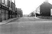
Taken from Stockton Street with the Salvation Army HQ on the left. THe first street off on the left is Fawcett Street and on the right at the end of the terrace of houses is Swainson Street.
The road continues into Villiers Street.
The photo was from a photographic record of the Central Area of West Hartlepool prepared in 1955/6 at the request of the Town Planning and Redevelopment Committee 'in the hope that it will be of interest to future generations of West Hartlepool'
The record focuses on areas which were within the next ten years to be completely redeveloped following The Max Lock Plan. It was compiled by WL Taylor and photographs developed by Thomas Clarkson Chemist of Tower Street.
More detail » Former Yuills Offices, Villiers Street (1)
 Donated by Hartlepool Library Service
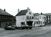
Former Yuills Offices, Villiers Street
More detail » Former Yuills Offices, Villiers Street (2)
 Donated by Hartlepool Library Service
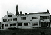
Former Yuills Offices, Villiers Street with St John's Presbyterian Church in Park Road in the background.
More detail » Gales Car Valet Service, Villiers Street
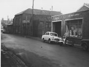 Donated by Hartlepool Museum Service
Gales Car Valet Service, Part of Gales Garage, Villiers Street. Near to where library is now.
More detail » Gales Garage
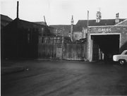 Donated by Hartlepool Museum Service
Service Dept., Gales Garage, Villiers Street.
More detail » Northerns Cinema
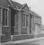 Created by Bill Boagey
Donated by Hartlepool Museum Service
Created by Bill Boagey
Donated by Hartlepool Museum ServicePart of the Bill Boagey collection
York Road corner with Villiers Street. This is a side view and it was originally the Oddfellows Hall. The Central Library now stands on the site.
More detail » Stockton Street Sawmills 1
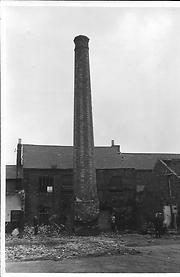 Part of the Library collection
Dated 1966
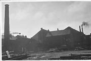
Just before demolition in 1966. The sawmill was on a square of land bordered by Stockton St/Ward St/ Villiers St and Thornton St.
The bottom of the chimney appears to be being prepared for demolition.
HHT&N 921
More detail » Villiers St Yuills Office
 Part of the Library collection
Taken just prior to demolition in the late 1960s, the image shows Yuill's Offices before a new building (since also demolished) was built in Belle Vue Way.
HHt&N 254
More detail » Villiers Street
 Donated by Hartlepool Library Service
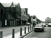
Villiers Street, Hartlepool looking towards York Road before the current Central Library. The buildinngs on the left have recently made way for a new samll shopping complex called Gemini.
More detail » Villiers Street
 Part of the Library collection
View is of the side of Yuill's Offices prior to demolition, with the College of Further Education in te background.
HHT&N 255
More detail » Villiers Street
 Part of the Hartlepool Museum Service collection
Dated 1961
Taken in 1961 the camera looks up Villiers Street towards York Road. The cars are in Carlton Street on the other side of York Road.
All buildings are now demolished, but the nearest building, before it became derelict was Buzz and Zoom and the Gemini nightclub.
More detail » Villiers Street
 Created by Bill Boagey
Donated by Hartlepool Museum Service
Created by Bill Boagey
Donated by Hartlepool Museum ServicePart of the Bill Boagey collection
Villiers Street. Building on left is J.W. Wall, Cabinet Maker, shop fitter, property repairs. Other properties include the Tin Box Factory, Ye Olde Durhams Club, Forbes Bakery, aerated water works and Hollidays Iron Works.
More detail » Villiers Street
 Donated by Hartlepool Museum Service
Villiers Street looking East. Bell Terrace in the background.
More detail » Villiers Street former Richardsons Club
 Part of the Library collection
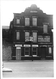
Prior to demolition, the building in Villiers Street has been used as Harry's Taxis and also Richardson Westgarth Sports and Social Club.
HHT&N 253
More detail » Villiers Street from the corner of Ouston Street
 Created by West Hartlepool Council
Part of the Hartlepool Library collection
Created by West Hartlepool Council
Part of the Hartlepool Library collectionDated 1956
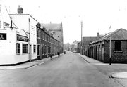
The offices of CM Yuill are on the left. The view looks towards York Road.
The photo was from a photographic record of the Central Area of West Hartlepool prepared in 1955/6 at the request of the Town Planning and Redevelopment Committee 'in the hope that it will be of interest to future generations of West Hartlepool'
The record focuses on areas which were within the next ten years to be completely redeveloped following The Max Lock Plan. It was compiled by WL Taylor and photographs developed by Thomas Clarkson Chemist of Tower Street.
More detail » Villiers Street looking East
 Donated by Hartlepool Library Service
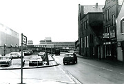
Villiers Street, Hartlepool looking East towards the original College of Further Education.
More detail » Villiers Street looking East now
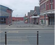 Donated by Harry Taylor
Looking East down Villiers Street with the Central Library on the left
More detail » Villiers Street looking East then
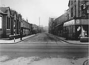 Donated by Harry Taylor
Looking East along Villiers Street with Gales Garage on the right and the Co-op Dairy in the distance. The building on the left where the Central Library now stands is The Northerns Cinema.
(Black photograph Album)
More detail » Villiers Street looking East then (2)
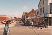 Donated by Harry Taylor
On the right is Gales Garage which sold Morris cars and had petrol pumps on the York Road side, although the garage was purely a showroom for new cars when this image was taken. Not long after the photo, the garage was closed and a bank built on the site.
More detail » Villiers Street looking east from York Road
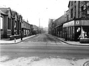 Created by West Hartlepool Council
Part of the Library collection
Created by West Hartlepool Council
Part of the Library collectionDated 1956
The Northerns Picture House (where the Central Library now stands) is on the left and Gales car showroom on the right and beyond that Forbes Bakery. The Coop dairy is in the left distance on the corner of Avenue Road.
More detail » Villiers Street then and now
 Created by Bill Stevenson
Donated by Hartlepool Library Service
Created by Bill Stevenson
Donated by Hartlepool Library ServiceVilliers Street, Hartlepool
More detail » Villiers Street then and now
 Created by Bill Stevenson
Donated by Hartlepool Library Service
Created by Bill Stevenson
Donated by Hartlepool Library ServiceVilliers Street, Hartlepool. the old warehousing on the left which was The Gemini Club in the 1980s was demolished around 2009 and a new small shopping complex, Gemini has been built on the site.
More detail » Waldon Street (1)
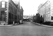 Created by West Hartlepool Council
Part of the Hartlepool Library Collection collection
Created by West Hartlepool Council
Part of the Hartlepool Library Collection collectionDated 1956
Looking at the part of Waldon Street, now demolished, between Park Road and Villiers Street,the education offices are of the right,on the left is property of JW Cameron and behind that is the Coop Bakery. In the background in Villiers Street is Gales Garage Service Department.
The photo was from a photographic record of the Central Area of West Hartlepool prepared in 1955/6 at the request of the Town Planning and Redevelopment Committee 'in the hope that it will be of interest to future generations of West Hartlepool'
The record focuses on areas which were within the next ten years to be completely redeveloped following The Max Lock Plan. It was compiled by WL Taylor and photographs developed by Thomas Clarkson Chemist of Tower Street.
More detail »


