 Hartlepool Sports & Leisure
- Cinemas, Theatres & Dance Halls
- Musicians & Bands
- At the Seaside
- Parks & Gardens
- Caravans & Camping
- Sport
 Hartlepool Transport
- Airfields & Aircraft
- Railways
- Buses & Commercial Vehicles
- Cars & Motorbikes
- The Ferry
- Horse drawn vehicles
 A Potted History Of Hartlepool
- Unidentified images
- Sources of information
- Archaeology & Ancient History
- Local Government
- Printed Notices & Papers
- Aerial Photographs
- Events, Visitors & VIPs
 Hartlepool Trade & Industry
- Trade Fairs
- Local businesses
- Iron & Steel
- Shops & Shopping
- Fishing industry
- Farming & Rural Landscape
- Pubs, Clubs & Hotels
 Hartlepool Health & Education
- Schools & Colleges
- Hospitals & Workhouses
- Public Health & Utilities
- Ambulance Service
- Police Services
- Fire Services
 Hartlepool People
 Hartlepool Places
 Hartlepool at War
 Hartlepool Ships & Shipping

Burn Road
Details about Burn Road
Burn Road, Hartlepool
Location
Related items :
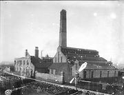
 BURN ROAD POWER STATION
 Donated by Hartlepool Library Service
Part of the Library collection collection
This shows what is probably the West Hartlepool Electricity Works and Burn Road can clearly be seen between the building and the railway line. The building to the left is most likely to be the Borough Electrical Engineer's Office. There was a coal depot at the bottom of Burn Road and it looks like coal on the railway trucks.
Although the railway lines are long gone, there is evidence of the remnants of an old railway bridge still in the Council Public Recycling Yard.
On the left of the picture beyond the bend in the road would now be JT Atkinson and further on the Tesco Extra Store.
HHT+N 363
More detail » Bensons Sadlers (1)
 Donated by Hartlepool Museum Service
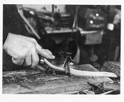
Mr Benson, the sadler, slicing a strip of leather.
More detail » Bensons Sadlers (2)
 Donated by Hartlepool Museum Service
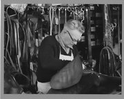
Mr Benson working on a saddle.
More detail » Bensons Sadlers (3)
 Donated by Hartlepool Museum Service
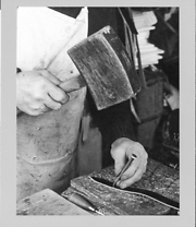
Punching a hole in a leather belt.
More detail » Bensons Sadlers (4)
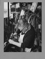 Donated by Hartlepool Museum Service
Mr Benson working on a saddle.
More detail » Bensons Sadlers (5)
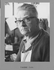 Donated by Hartlepool Museum Service
Portrait of Mr Benson. Printed on front border T. Marine C of A.
More detail » Burn Road
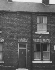 Donated by Hartlepool Museum Service
The front of 39 Burn Road, Hartlepool. Houses were on the North side between Green Street and Mozart Street.
More detail » Durham Paper Mill chimney from Burn Road
 Donated by Hartlepool Museum Service
The Durham Paper Mill chimney was a well-known local landmark and from December 1954, the lettering was lit up in red neon lights at night. The Paper Mill ceased production in 1965 and the chimney was demolished in 1971. Part of the paper mill building is still in use as a wallpaper store in Moreland Street.
This view of Burn Road is looking towards Stranton and the Tesco traffic lights are around the same spot today.(2014)
More detail » J.T. Atkinson, Builders Merchant
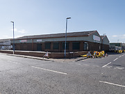 Created by Don Stephenson
Donated by Don Stephenson
Created by Don Stephenson
Donated by Don StephensonJ.T. Atkinson, Builders Merchant, Burn Road, Hartlepool.
More detail » Jackson's Fuels
 Donated by HBC
Part of the Library collection
Dated 1986
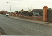
Taken in November 1986. Part of the site is now the Council Recycling Area and part another business.
HHT&N 860
More detail » Junction of Burn Road and Stockton Street - then and now
 Created by Bill Stevenson
Donated by Hartlepool Library Service
Created by Bill Stevenson
Donated by Hartlepool Library ServiceDated 2012
The junction of Burn Road and Stockton Street, West Hartlepool.
More detail » Junction of Burn Road with Stockton Street
 Donated by Hartlepool Library Service
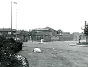
Junction of Burn Road with Stockton Street, Hartlepool
More detail » View of Burn Road area
 Part of the Hartlepool Museum Service collection
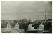
Probably taken from a roof at the south end of Lynn Street, the houses on the far left would be those at the bottom of Burn Road and the other side of the road was a coal depot. The next street to the right would be Bedford Street and then Seamer Street on the far right. The council destructor chimney in Burn Road can clearly be seen and in the distance the tower of St Aidan's Church.
More detail »


