 Hartlepool Sports & Leisure
- Cinemas, Theatres & Dance Halls
- Musicians & Bands
- At the Seaside
- Parks & Gardens
- Caravans & Camping
- Sport
 Hartlepool Transport
- Airfields & Aircraft
- Railways
- Buses & Commercial Vehicles
- Cars & Motorbikes
- The Ferry
- Horse drawn vehicles
 A Potted History Of Hartlepool
- Unidentified images
- Sources of information
- Archaeology & Ancient History
- Local Government
- Printed Notices & Papers
- Aerial Photographs
- Events, Visitors & VIPs
 Hartlepool Trade & Industry
- Trade Fairs
- Local businesses
- Iron & Steel
- Shops & Shopping
- Fishing industry
- Farming & Rural Landscape
- Pubs, Clubs & Hotels
 Hartlepool Health & Education
- Schools & Colleges
- Hospitals & Workhouses
- Public Health & Utilities
- Ambulance Service
- Police Services
- Fire Services
 Hartlepool People
 Hartlepool Places
 Hartlepool at War
 Hartlepool Ships & Shipping

Town Wall
Details about Town Wall
Town Wall, Hartlepool Headland
Location
Related items () :
 1925 - Seamen's Institute -
 Created by Unknown
Donated by Ian Fletcher
Created by Unknown
Donated by Ian FletcherPart of the Hartlepool BBOB RFC collection
Dated 1926
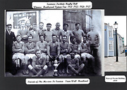
The Institute team with the Pyman Cup in 1925, taken outside their Town Wall Headquarters. The building still stands and can be seen in the photo on the right and is today a private dwelling.
Although no details came with the image the club had been knocked out of the County Cup by the eventual winners, Heortensians,see their image of this site, but they retained their hold on he Pyman League trophy, their only haul for the season.
A typical Seamen’s Inst 1st XV of this season was H Allen; F Bennison, A Johnston, R Watson, T Metcalfe; LL Stevenson & G Wardrop; W Sanderson, S Doyle, J Doyle, A Brownless, T Stothard, A Weston, T Peak & J Watt, Reserve W Brown, many of them may be on this photograph.
More detail »
 Boats on Fish Sands
 Donated by Hartlepool Museum Service
Fishing boats moored on Fish Sands. Sandwell Gate, in the town wall, in the background.
HHT+N 592
More detail » Ferry steps from Middleton
 Donated by Hartlepool Museum Service
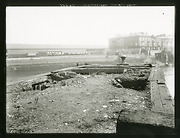
Photo taken from a point just north of a middleton ferry landing. Town Wall buildings at right. Fish Quay buildings at left. Headland ferry steps at right.
HHT&N 792
More detail » Fish Sands
 Donated by Douglas Ferriday
Part of the Hartlepool Library Service collection
Dated 1970
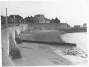
A view of the Fish Sands with the Harbour of Refuge public house (also known as the Pot House) in the distance. The Town Wall dates from the fourteenth century. Hartlepool is the only walled town without a castle in England.
More detail » Fish Sands
 Donated by Hartlepool Museum Service
Cambridge buildings on right. The public house on the beach is Freemason's Arms. (jane hunter and The Sands was nickname). The pub was opened 1851. It was closed 1898 and demolished 1906. The rounded building was a water tower (on 1914 map named as a sewage tank). The pub just left of Sandwell Gate was The Alma was built in 1830s and demolished in 1935 .
HHT+N631
More detail » Fish Sands and Town Wall
 Donated by Hartlepool Museum Service
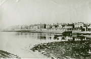
A view of the Fish Sands and Town wall probably c1900. Note the fishing nets hung over the wall to dry.
More detail » Fish Sands and Town Wall
 Donated by Hartlepool Museum Service
A lot of boats on the Fish Sands, including one for hire. A good view of the houses on the Town Wall.
More detail » Fish Sands and Town Wall
 Donated by Hartlepool Museum Service
Picture of the Fish Sands and Town Wall from the Pilots Pier.
More detail » Fish Sands c1895
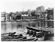 Donated by Douglas Ferriday
Part of the Hartlepool Library Service collection
Picture of Fish Sands from 1895 showing that the area was quite busy with quite a few cobles moored at the Pilot Pier and some beached on the sands. The Freemasons' Arms was the public house on the beach.
HHT+N 591
More detail » Fishing Fleet on the Fish Sands
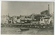 Donated by Hartlepool Museum Service
Fishing Fleet on the Fish Sands.
From left Alma. Sandwell gate. Fish car gate. Flour Factory (top) with chimney (Blue Anchor Pub. Jane Hunter & "The Sands" (Freemanson's Arms or Fisherman's Arms)
More detail » Fishing Vessel coming in to port
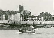 Donated by Hartlepool Museum Service
A Fishing Vessel A248 heading back in to port with st Hilda's Church in the background.
More detail » Gospel Hall
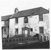 Donated by Douglas Ferriday
Part of the Hartlepool Library Service collection
Dated 1967
The Gospel Hall on the Town Wall, old Hartlepool.
More detail » Pilot Pier through Sandwell Gate
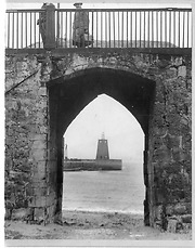 Donated by Hartlepool Museum Service
A picture of the Pilot Pier and lighthouse taken through the Sandwell Gate. Photographer stood in Sandwell Chare.
More detail » Repairs to Town Wall
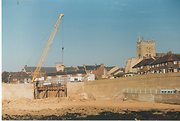 Created by Francis Elsdon
Donated by Hartlepool Museum Service
Created by Francis Elsdon
Donated by Hartlepool Museum ServicePart of the Elsdon Collection collection
Dated 1986
Repairs to Town Wall at the Fish Sands, old Hartlepool.
More detail » Sandwell Chare
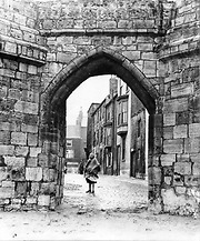 Donated by Hartlepool Museum Service
Picture of woman in Sandwell Chare, The Croft, taken through Sandwell gate. date not known
More detail » Sandwell Chare - 1890
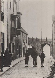 Created by James Whitehead Pattison
Donated by Bowes Museum, Barnard Castle, County Durham
Created by James Whitehead Pattison
Donated by Bowes Museum, Barnard Castle, County DurhamPart of the Pattison's Photographs collection
Dated 1890
Children walking up Sandwell Chare towards the Sandwell Gate, town wall. Note the lady leaning out of the window. The houses, in an area known as the Croft, have now all been demolished.
More detail » Sandwell Chare 1908
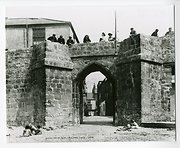 Donated by Hartlepool Museum Service
Ancient Watergate Sandwell Chare 1908 leading from the Fish Sands.
Sandwell Chare/Town Wall taken from beach looking up through Sandwell Gate. The buildings, the Croft, have been demolished & street level has been raised.
More detail » Sandwell Gate
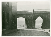 Donated by Hartlepool Museum Service
Shows Sandwell Gate & gate at angle for wagons. Taken from Sandwell Chare. On left Blue Anchor pub which closed in 1897.
More detail »
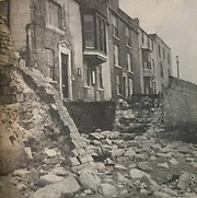
 Storm 1966
 Created by NDM
Donated by Hartlepool Museum Service
Created by NDM
Donated by Hartlepool Museum ServiceDated 1966
On 9th February 1966, a bad storm badly damaged the Town Wall. £7000 worth of damage was caused at the Gospel Mission and the Port and Harbour Commisioners' Offices.
More detail » Storm damage at old Hartlepool
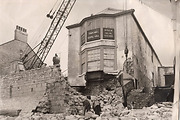 Donated by Mr. Bobby Black
Storm damage to the Town Wall and Gospel Hall.
More detail » Strolling on the Town Wall
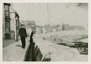 Donated by Hartlepool Museum Service
The man strolling is David Bunton a ferryman post 1930. The Fish Sands can be seen along with The Croft and the Harbour of Refuge PH.
More detail » The Croft
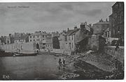 Donated by Mike Oxley
The Croft, Hartlepool. Situated on Hartlepool Headland next to the Fish Sands.
More detail » The Harbour and Town wall (Fish Sands)
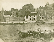 Donated by Hartlepool Museum Service
This actually shows the Fish Sands and Town Wall. Shows pub "Joan Hunter & the Sands", background Cambridge Buildings, Flour Mill Above.
HHT+N 593
More detail » The Town Wall
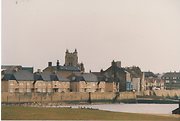 Created by Francis Elsdon
Donated by Hartlepool Museum Service
Created by Francis Elsdon
Donated by Hartlepool Museum ServicePart of the Elsdon Collection collection
Dated 1986
The Town Wall, old Hartlepool. St Hilda's Church in the background.
More detail » The Town Wall and Harbour
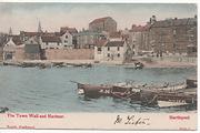 Donated by Mike Oxley
The Town Wall and Harbour, Hartlepool Headland taken from a postcard around 100 years old
More detail » Town Wall
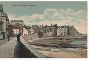 Donated by Mike Oxley
Town Wall, Hartlepool Headland taken from a postacard around 100 years old
More detail » Town Wall
 Donated by Hartlepool Museum Service
Part of the David Wise collection
View from Middleton 1980s.
More detail » Town Wall - c1890
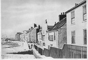 Donated by Maureen Anderson
Children stand in front of John French's Whitby Hotel on the Town Wall. In the distance is the shipyard of Withy and Co.
More detail » Town Wall 1
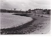 Donated by Andrew Stewart
This photograph shows the entrence to Hartlepool Harbour and the Fish Sands at low tide. In the distance you can see CMEW and the Swan Necked Crane.
More detail » Town Wall 1967
 Donated by Hartlepool Library Service
Part of the Library collection collection
Dated 1967
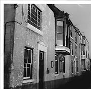
The photo shows houses on the Town Wall old Hartlepool close to Sandwell Gate in January 1967 and they are still there today. The first house in the picture has a doorplate and two notices on the walls. Does anyone know what the building was used for in 1967 ?
HHT&N 152
More detail » Town Wall 1972
 Donated by Douglas Ferriday
Part of the Hartlepool Library Service collection
Dated 1972
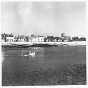
The Town Wall, old Hartlepool, in 1972, with St Hilda's Church on the right.
More detail » Town Wall and Fish Sands
 Donated by Douglas Ferriday
Part of the Hartlepool Library Service collection
Dated 1967
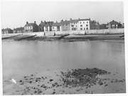
A view of the Town Wall, showing the fourteenth century defences along the Fish Sands.
More detail » Town Wall and Fish Sands
 Donated by Hartlepool Library Service
A view of the Town Wall and Fish Sands. with the swan neck crane and the CMEW Crane in the background.
More detail » Town Wall and houses - 1890
 Created by James Whitehead Pattison
Donated by Bowes Museum, Barnard Castle, County Durham
Created by James Whitehead Pattison
Donated by Bowes Museum, Barnard Castle, County DurhamPart of the Pattison's Photographs collection
Dated 1890
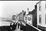
Coastguards having a chat to the locals on the Town Wall in 1890.
More detail » Town Wall and houses - 2007
 Created by Maureen Anderson
Donated by Maureen Anderson
Created by Maureen Anderson
Donated by Maureen AndersonDated 2007
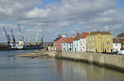
The Town Wall in 2007. The Georgian houses dating from the late 1700s on the left have been beautifully renovated.
More detail » Town Wall cobles
 Donated by Hartlepool Museum Service
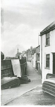
View looking West with Sandwell Gate, The Croft, on left & Sandwell Chare going off on right. Cobles stored by wall.
HHT&N 621
More detail » Town Wall from Middleton
 Donated by Hartlepool Museum Service
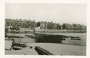
Taken from Middleton showing town wall & the Ferry on the left. Spine of St. Mary's to right of centre and St. Hilda's on left
More detail » Town Wall from the Fish Sands c1940
 Donated by Hartlepool Museum Service
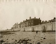
The Town Wall from the Fish Sands with the swan necked crane in the background.
More detail » Town Wall old Hartlepool
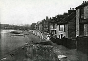 Donated by Hartlepool Library Service
Town Wall old Hartlepool
More detail » Town Wall then and now
 Created by Bill Stevenson
Donated by Hartlepool Library Service
Created by Bill Stevenson
Donated by Hartlepool Library ServiceTown Wall, Hartlepool Headland
More detail » Town wall c1940
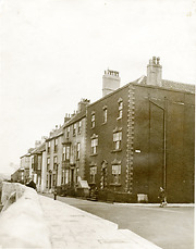 Donated by Hartlepool Museum Service
Picture of the houses on the Town Wall taken c1940.
The first few houses on the left date from the late 1700s, are Grade 2 listed and are now some of the oldest properties in the town.
More detail » Trawler coming in to port
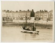 Donated by Hartlepool Museum Service
Trawler heading in to port.
More detail » View from the Pilot Pier, St Andrew's Church
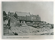 Donated by Hartlepool Museum Service
View from the Pilot Pier of the beach below York Place. St. Andrew's Church is in centre of Photograph. The small buildiing on the left was late taken over by the firm constructing the Heugh breakwater.
Note all the fishing nets drying over the town wall.
More detail »


