 Hartlepool Sports & Leisure
- Cinemas, Theatres & Dance Halls
- Musicians & Bands
- At the Seaside
- Parks & Gardens
- Caravans & Camping
- Sport
 Hartlepool Transport
- Airfields & Aircraft
- Railways
- Buses & Commercial Vehicles
- Cars & Motorbikes
- The Ferry
- Horse drawn vehicles
 A Potted History Of Hartlepool
- Unidentified images
- Sources of information
- Archaeology & Ancient History
- Local Government
- Printed Notices & Papers
- Aerial Photographs
- Events, Visitors & VIPs
 Hartlepool Trade & Industry
- Trade Fairs
- Local businesses
- Iron & Steel
- Shops & Shopping
- Fishing industry
- Farming & Rural Landscape
- Pubs, Clubs & Hotels
 Hartlepool Health & Education
- Schools & Colleges
- Hospitals & Workhouses
- Public Health & Utilities
- Ambulance Service
- Police Services
- Fire Services
 Hartlepool People
 Hartlepool Places
 Hartlepool at War
 Hartlepool Ships & Shipping

Aerial photographs
Details about Aerial Photographs
A selection of aerial photographs of Hartlepool and the surrounding area.
Location
Related items () :
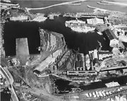
 Aerial Photograph of West Hartlepool Dock System
 Donated by Hartlepool Museum Service
Part of the Shipbuilding collection
Aerial Photograph of West Hartlepool Dock System showing Gray's North yard in the foreground and remnants of the mothball fleet in the background.
More detail » Aerial Shot of Hartlepool Town Centre area 1945
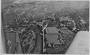 Donated by Hartlepool Library Service
Aerial Shot of Hartlepool Town Centre area 1945
More detail » Aerial Shot of Seaton Carew
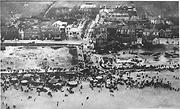 Donated by Hartlepool Library Service
Aerial Shot of Seaton Carew, Hartlepool showing Church Street and The Front
More detail » Aerial Shot of West Park area of Hartlepool 1945
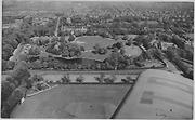 Donated by Douglas Ferriday
Part of the Hartlepool Library Service collection
Aerial Shot of West Park area of Hartlepool with Park Drive Cricket Club In the foreground. To the left, the pavilion, still there today, can be seen. Elwick Road run horizontally on the image and on the other side of this is Ward Jackson Park and the houses in Park Avenue behind this.
hhy&n 1069
More detail » Aerial View of Church Street area
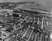 Donated by Hartlepool Library Service
Aerial View of Church Street area, Hartlepool. The original shopping area around Lynn Street is still there and a good view of the docks
More detail » Aerial View of Hartlepool Town area
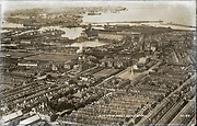 Donated by Hartlepool Library Service
Aerial View of Hartlepool Town area before the Civic Centre was built. It also show a lot of the dock area.
HHT+N 483
More detail » Aerial View of Seaton Fairground 1946
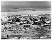 Donated by Douglas Ferriday
Part of the Hartlepool Library Service collection
An aerial view of Seaton Fairground from 1946 not long after it was set up. Shows still seem to be on sand.
More detail » Aerial View of the Deep Water Berth
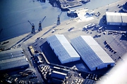 Donated by Mr. John Brooker
Aerial View of the Deep Water Berth area Hartlepool Docks, showing cargo storage sheds (Pulp, Newsprint, timber) outside timber storage areas, the Dockmasters Office, and the lock gates leading to the North Basin.
More detail » Aerial View of the Docks (1)
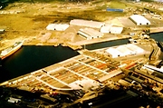 Donated by Mr. John Brooker
Aerial View Hartlepool Docks, showing Central Dock (left), North Basin (centre), Victoria Dock (right). and the area known as “The Slake” in the background. Cargo Storage sheds, and a vehicle import storage area are in the foreground.
More detail » Aerial View of the Docks (2)
 Donated by Mr. John Brooker
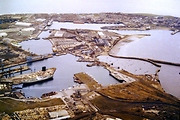
Aerial view of the West Harbour area, with May & Hassle, Timber Importers middle foreground. The Ship Egton is tied up on 'A' Jetty, Union Dock. To the right is the Coal Dock, with HMS Warrior undergoing restoration, with Union Dock, Central Dock, North Basin, and Victoria Dock.
More detail » Aerial photo circa 1945 Dyke House and Brougham Schools
 Donated by Hartlepool Library Service
Part of the Hartlepool Library Collection collection
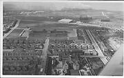
Dated 1945
Photo will probably have been taken when Dyke House School was opened in 1945 having been built just before WW2. The road in the middle leading up to Dyke House School is Mapleton Road (then called Hart Street being changed in 1967 because of another Hart Street on the Headland) The school in the foreground is the original Brougham which is now an enterprise centre.
The road on the right is Milbank Road which at the time did not reach Powlett Road. The new factory in Powlett Road is Prices Tailors, the first factory opened on the trading estate in 1945. The roundabout where Easington, Raby and Powlett Roads and Winterbottom Ave meet had not been constructed and would later be in the top left.
More detail » Aerial photo of Church Street
 Donated by Hartlepool Library Service
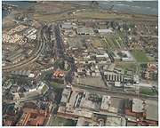
Aerial photo of Church Street and the surrounding area. Christ Church in the middle of the picture. Note the wood on the docks, long past nowadays.
More detail » Aerial photo of The General Hospital, Hartlepool
 Donated by Hartlepool Library Service
Aerial photo of The University Hospital (Hartlepool General), Hartlepool with the A1086 Coast Roast in the foreground.
More detail » Aerial photo of The General Hospital, Hartlepool
 Donated by Hartlepool Library Service
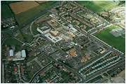
Hartlepool General Hospital from the air.
More detail » Aerial shot of Seaton Carew Front
 Donated by Hartlepool Library Service
A great shot of Seaton Carew from the air. Going from left to right. The fairground, the bus station, Longscar Hall being built, the paddling pool with The Marine Hotel opposite and the North Shelter. Over to the right you can see Holy Trinity Church and the school.
HHT&N 559
More detail » Aerial shot of Seaton Carew c1945
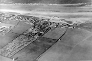 Donated by Hartlepool Library Service
an aerial shot of Seaton Carew c1945 before a lot of the area was developed into housing. Holy Trinity Church and the Primary school can be seen.
HHT&N 563
More detail » Aerial view of Dyke House School
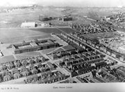 Donated by Hartlepool Library Service
Aerial view of Dyke House School. The gas works can be seen in the background. The white building is Price Tailors, the first factory on the trading estate.
HHT&N 580
More detail » Aerial view of Hartlepool
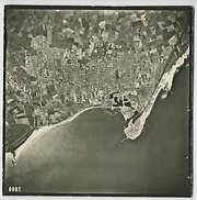 Donated by Hartlepool Museum Service
Aerial view of Hartlepool, c1961
More detail » Aerial view of Hartlepool Docks
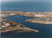 Donated by Hartlepool Museum Service
Aerial view of Hartlepool Docks.
More detail » Aerial view of Seaton Carew
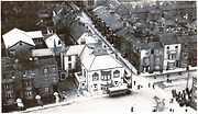 Donated by Maureen Anderson
This image, probably 1930s or 40s shows buildings between Ashburn Street and The Front and behind the Seaton Hotel. Except for those in Church Street and along The Front itself they are now all gone including the Quaker Chapel which is directly behind what is now the Durham Hotel.
More detail » Aerial view of Southgate
 Donated by Hartlepool Museum Service
Hartlepool Ferry is on the centre right. On the skyline, from left to right is the spire of St. Mary's Church, St. Hilda's Church tower and the Borough Hall building.
HHT+N 626
More detail » Aerial view of West Hartlepool Docks
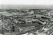 Donated by Hartlepool Library Service
Aerial view of Hartlepool Docks. Not know when picture was taken but there is a steam train at the bottom of the picture.
HHT&N 480
More detail » Aerial view of old Hartlepool
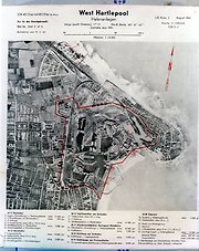 Donated by Hartlepool Library Service
Aerial view of old Hartlepool taken by German aircraft during WW2. Places to bomb listed.
HHT+N 482
More detail » Aerial view of the docks
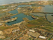 Donated by Hartlepool Library Service
Aerial view of the docks. St Hilda's Church can be made out in the top right hand corner and Church Street bottom left.
HHT+N 718
More detail » After the Fire
 Donated by Annette Ogle
Dated 1953
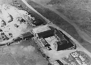
An aerial view of Hart Warren Farm in 1953, after a devastating fire which destroyed the piggeries (bottom right of the photograph), and a couple of storage barns. Top left are the stack yards, and the van in the centre foreground, was used to deliver milk.
More detail » Brierton Hospital from the air
 Donated by Hartlepool Library Service
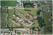
A shot of Brierton Hospital, Brierton Lane, from the air. Premises are now demolished. West Hartlepool Rugby Club premises can be seen top left. The club has now moved and new housing stands on the plot.
More detail » Cameron Hospital from the air
 Donated by Hartlepool Library Service
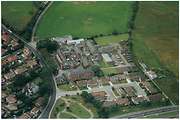
A shot of Cameron Hospital, Serpentine Road, Hartlepool, from the air. The building is almost centre to the picture.
More detail » Church Square
 Donated by Hartlepool Library Service
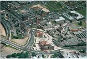
Church Square and Street from the air.
More detail » Church Square (2)
 Donated by Hartlepool Library Service
A close look at Church Square.
More detail » Church Street and Hartlepool Docks
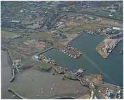 Donated by Hartlepool Library Service
Church Street and Hartlepool Docks from the air. Before the docks were transformed into the Marina we have today.
More detail » Church Street and Hartlepool Docks (2)
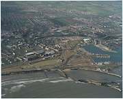 Donated by Hartlepool Library Service
Another view of Church Street and Hartlepool Docks before the Marina development.
More detail » Church Street and Hartlepool Marina
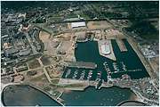 Donated by Hartlepool Library Service
Church Street and Hartlepool Marina from the air.
More detail » Church Street and Hartlepool Marina (2)
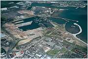 Donated by Hartlepool Library Service
Church Street and Hartlepool Marina from the air. This was taken at the time cars were being imported through Hartlepool. See top left of picture.
More detail » Church Street and Hartlepool Marina (3)
 Donated by Hartlepool Library Service
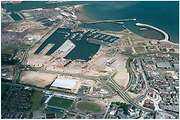
Church Street and Hartlepool Marina from the air. Jackson's Landing is just to left of centre.
More detail » Deep Water Berth and Fish Quay
 Donated by Hartlepool Library Service
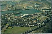
An aerial shot of the deep water berth and the fish quay. Durham Street and Northgate can also be seen.
More detail » Eldon Grove aerial view
 Part of the Library collection collection
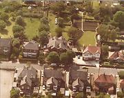
On the bottom left is part of the grounds of Eldon Grove Spa Centre (now part of Eldon Grove Tennis Club) The gardens in Eldon Grove are large and along the top of the photo are the gardens of Claremont Drive.
HHT&N 241
More detail » HMS Warrior aerial view
 Donated by Hartlepool Museum Service
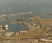
Here the Warrior's refurbishment is almost complete. The ship to the left is the Egton.
More detail » Hartlepool Marina from the air
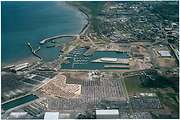 Donated by Hartlepool Library Service
Hartlepool Marina from the air with Jackson's Landing in the centre. Car imoprt business booming with numerous new vehicles parked on waste land.
More detail » Hartlepool Marina from the air
 Donated by Hartlepool Library Service
Hartlepool Marina from the air with new houses just being built.
More detail » Hartlepool Marina from the air
 Donated by Hartlepool Library Service
Hartlepool Marina from the air. A shot of the entrance to the Marina.
More detail » Hartlepool Sea Front from the air
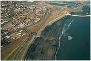 Donated by Hartlepool Library Service
Hartlepool Sea Front from the air. Newburn Bridge is where the bend in the road is. The road to the right of this is Mainsforth Terrace. The Docks can be seen top right.
More detail » Mainsforth Terrace and Church Street
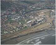 Donated by Hartlepool Library Service
Mainsforth Terrace and Church Street from the air.
More detail » Marina and Docks - 2012
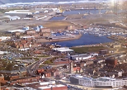 Created by John Reed
Donated by Davis Mills
Created by John Reed
Donated by Davis MillsDated 2012
A view of Hartlepool Marina and the surviving Docks, taken by local helicopter pilot John Reed, last year.
More detail » Marina and Dyke House
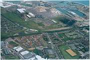 Donated by Hartlepool Library Service
Marina and Dyke House from the air. Dyke House School bottom right of picture. Lancaster Road and Powlett Road also in the picture.
More detail » Marina and Dyke House (2)
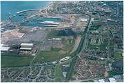 Donated by Hartlepool Library Service
Marina and Dyke House from the air. Lancaster Road and Powlett Road in the picture.
More detail » New houses on the Marina
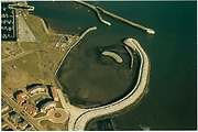 Donated by Hartlepool Library Service
Some of the first new houses on th Marina. They are now surrounded by other buildings.
More detail » Old Hartlepool from the air
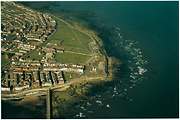 Donated by Hartlepool Library Service
Old Hartlepool from the air. The Heugh Breakwater can be seen along with the lighthouse. the town moor and the war memorial.
More detail » Old Hartlepool from the air (2)
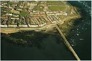 Donated by Hartlepool Library Service
Old Hartlepool from the air with the Heugh Breakwater in the foreground.
More detail » Old Hartlepool from the air (3)
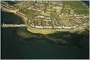 Donated by Hartlepool Library Service
Old Hartlepool from the air with the Pilot's Pier to the left.
More detail » Old Hartlepool from the air (4)
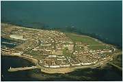 Donated by Hartlepool Library Service
A complete shot of old Hartlepool from the air.
More detail » Old Hartlepool from the air (5)
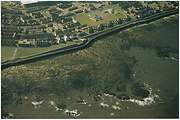 Donated by Hartlepool Library Service
The sea front and Fairy Cove Terrace in this picture. St Helen's School if the building surrounded by grass.
More detail » Old Hartlepool, The Fish Quay and the Deep Water Berth
 Donated by Hartlepool Library Service
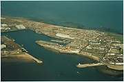
Old Hartlepool, The Fish Quay and the Deep Water Berth from the air. The Pilot Pier bottom right.
More detail » Seaton Carew from the air
 Donated by Hartlepool Library Service
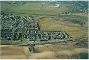
Aerial photo of Seaton Carew. The Staincliffe Hotel is the white building with the car park. Probably from the 90s as the sea wall is still under construction
More detail » Seaton Carew from the air
 Donated by Hartlepool Library Service
Another picture of Seaton Carew from the air. The white building is the Norton Hotel on The Green.
More detail » Seaton Carew from the air
 Donated by Hartlepool Library Service
Another shot of Seaton Carew from the air. The Norton Hotel is the white building on the right. Station Lane is the main road to the right of the picture and Holy Trinity Church can just be made out, just to left of centre.
More detail » View of Elwick Road circa 1954
 Created by Aerofilms
Part of the Hartlepool Museum Service collection
Created by Aerofilms
Part of the Hartlepool Museum Service collectionDated 1954
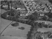
The two large houses in the foreground looking over the Burn Valley Gardens, are Ambleside on the left and Rosebank on the right and these formed Rosebank School. The large white house on the top left on the Elwick Road/ Queensberry Ave corner is Hartdale which is still there today although it is divided into two homes. The large white house top centre was Broomhill home of the Forslind family. This house was demolished in 1970 and a number of bungalows occupy the site.
Newlands Ave is the road in the centre running vertically and Westlands, Northlands, Eastlands, Southlands Avenues can be seen having been built after WW2. Claremont Drive can be seen but is very incomplete and only the first few houses built for RAF (Army ?) personnel are apparent on the top right.
More detail »


