 Hartlepool Sports & Leisure
- Cinemas, Theatres & Dance Halls
- Musicians & Bands
- At the Seaside
- Parks & Gardens
- Caravans & Camping
- Sport
 Hartlepool Transport
- Airfields & Aircraft
- Railways
- Buses & Commercial Vehicles
- Cars & Motorbikes
- The Ferry
- Horse drawn vehicles
 A Potted History Of Hartlepool
- Unidentified images
- Sources of information
- Archaeology & Ancient History
- Local Government
- Printed Notices & Papers
- Aerial Photographs
- Events, Visitors & VIPs
 Hartlepool Trade & Industry
- Trade Fairs
- Local businesses
- Iron & Steel
- Shops & Shopping
- Fishing industry
- Farming & Rural Landscape
- Pubs, Clubs & Hotels
 Hartlepool Health & Education
- Schools & Colleges
- Hospitals & Workhouses
- Public Health & Utilities
- Ambulance Service
- Police Services
- Fire Services
 Hartlepool People
 Hartlepool Places
 Hartlepool at War
 Hartlepool Ships & Shipping

York Road
Details about York Road
York Road.
Location
Related items () :
 York Road Police phone
 Created by NDM
Donated by Hartlepool Museum Service
Created by NDM
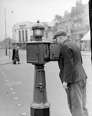
Donated by Hartlepool Museum ServiceThis photo from the early 1950s,shows a police phone box on the crossroads at York Road and Victoria Road. Police phone boxes are from a different era, when there were no other efficient ways of communication with the police station when police were out on the streets.
In the background is the Essoldo/ Regal which is now of course a Bingo Hall.
More detail » Bernard Povey York Road
 Part of the Library collection collection
Dated 1974
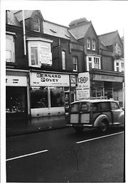
Dated December 1974, Bernard Povey Carpets next door to the Coop Decorating Department. St George's Church is just out of sight to the right. Above the carpet shop is Michael Gerrard Hairdressers which at the time was one of 'the' places for ladies to have their hair styled. An advert for Gerrard's is under the Coop sign. John Gent's Firearms and fishing tackle is now where Povey's was. Also of note is the Morris Traveller car and above it one of the Christmas trees which were festooned across York Road for many years at this time of year.
HHT&N 249
More detail » Brewis Automobiles
 Donated by Hartlepool Museum Service
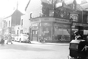
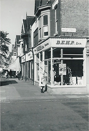
Brewis Automobiles shop, 125 York Road, West Hartlepool which is on the corner of York Road and Thornton Street. The shops in the image still exist opposite the Central Library.
More detail » Central Library, York Road
 Donated by Hartlepool Library Service
Part of the Library collection collection
Dated 1991
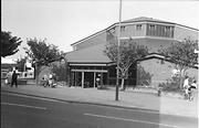
Taken in 1991 not long after the new Central Library, on the site of the old Northerns Cinema in York Road, opened to replace the building in Church Square.
HO4071
More detail » D.M. Brown
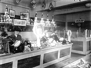 Donated by Douglas Ferriday
Part of the Hartlepool Library Service collection
D.M. Brown's Grocery Store, 96 York Road, West Hartlepool.
More detail » Discount Furnishings York Road 1970
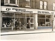 Donated by Gillian Smith
Dated 1970
Taken in 1970, Robert Smith who was then working for Hartlepool Mail can be seen talking to the lady on the left. The shop belonged to Hinton's and was on the block between Park Road and Gill Street. THe left hand part of the building is now part of the Nat West Bank and the right hand part a clothing store.
More detail » Duncans, York Road
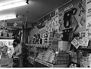 Created by Douglas Ferriday
Part of the Library collection collection
Created by Douglas Ferriday
Part of the Library collection collectionDated 1966
Taken in 1966, Huntley and Palmer's breakfast biscuits seem to be 1 shilling a packet (5p), pink salmon is 1 shilling and sixpence (7 and a half pence) and the store seems to be doing a promotion on 'Best food from Poland'.
HHT+N 750
More detail » Essoldo
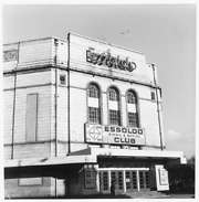 Donated by Douglas Ferriday
Part of the Hartlepool Library Service collection
Dated 1972
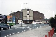
The Essoldo Bingo and Social Club, formerly the Regal Cinema.
More detail » Gill Street to York Road
 Created by Mr. Billy Henderson
Donated by Mr. Billy Henderson
Created by Mr. Billy Henderson
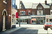
Donated by Mr. Billy HendersonA view of Gill Street looking on to York Road. Date unknown.
More detail » Jackson & Dunn Ltd.
 Donated by Hartlepool Museum Service
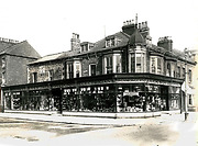
Sales Department of Jackson & Dunn Ltd., Ironmongers, Plumbers and Electricians, 107 York Road, West Hartlepool.
HHT+N 726
More detail » Jones Monumental Mason
 Donated by Hartlepool Library Service
Part of the Library collection collection
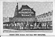
On the corner of Raby Road (then Hart Road) to the left and York Road to the right stood Jones's Monumental Works. The signage says established 1872. Today across the road from Mill House Baths there is an empty site and advertising hoardings in the place of the business.
The reverse of the picture says Francis Jones Memorial Sculptor.
HHT&N 902
More detail » Looking south down York Road now
 Donated by Harry Taylor
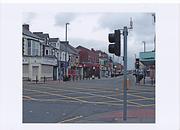
Looking South down York Road, Hartlepool from Victoria Road.
More detail » Looking south down York Road then
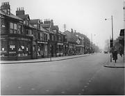 Created by West Hartlepool Council
Donated by Harry Taylor
Created by West Hartlepool Council
Donated by Harry TaylorDated 1956
Looking south down York Road from Victoria Road, Hartlepool.
On the far right of the image is scaffolding where the Coop Chemist Store is in the process of being built. Beyond that on the right hand side of York Road, the signage for Bruce Moore's can be seen on the corner of South Road. On the other side of South Road was York Road Methodist Church and the top of St George's Church can just be seen.
On the left hand side of York Road, the shops still exist but under different ownership. Brough's General Dealers and Pools Dye Works can be seen and the white building with the diamond shaped advert was Frank Wright's Bookseller and Toy Shop.
The traffic lights were one of the few sets in the town at the time.
The photo was from a photographic record of the Central Area of West Hartlepool prepared in 1955/6 at the request of the Town Planning and Redevelopment Committee 'in the hope that it will be of interest to future generations of West Hartlepool'
The record focuses on areas which were within the next ten years to be completely redeveloped following The Max Lock Plan. It was compiled by WL Taylor and photographs developed by Thomas Clarkson Chemist of Tower Street.
More detail » Moorhouse store on corner of York Road and Park Road
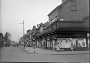 Created by NDM
Donated by Hartlepool Museum Service
Created by NDM
Donated by Hartlepool Museum ServiceTaken around 1953, this is an unusual view looking north along York Road from near St George's Church. One of only a very small number of traffic lights in the town can be seen on the corner of Park Road and York Road. The Moorhouse store was in the Regent Buildings And sold mainly clothing and curtaining. In the mid 1960s, Ron Richardson took over the shop. The buildings were demolished in 1976 and a Barclays Bank is now on the site.
Further along on the right, Gales' garage can be seen and the church tower on the left is York Road Methodist Church.
More detail » Northerns Bingo Club
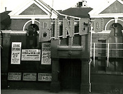 Donated by Hartlepool Library Service
Northerns Bingo and Social Club, this is now the site of the current Central Library in York Road, Hartlepool
(Then & Now Project CDR Img0044)
More detail » Northerns Bingo Club York Road then and now
 Created by Bill Stevenson
Donated by Hartlepool Library Service
Created by Bill Stevenson
Donated by Hartlepool Library ServiceNortherns Bingo Club, York Road, Hartlepool then and now
More detail » Northerns Cinema
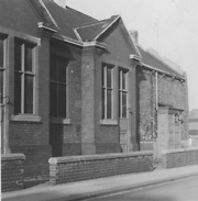 Created by Bill Boagey
Donated by Hartlepool Museum Service
Created by Bill Boagey
Donated by Hartlepool Museum ServicePart of the Bill Boagey collection
York Road corner with Villiers Street. This is a side view and it was originally the Oddfellows Hall. The Central Library now stands on the site.
More detail » Northerns Cinema
 Donated by Hartlepool Museum Service
Northerns Cinema, York Road, Hartlepool. It stood on the junction of Villiers Street where the Central Library is now. Picture taken in April 1960
More detail » Odeon Cinema side view from Dent St
 Donated by Hartlepool Library Service
Side view of the disused Odeon Cinema Hartlepool looking along Dent Street. Shottons furniture store in Raby Road across the top of the street.
hht&n 1067
More detail » Oscars
 Created by W Henderson
Donated by W Henderson
Created by W Henderson
Donated by W HendersonPart of the Hartlepool Public Houses collection
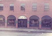
Oscars, York Road, Hartlepool. Hartlepool's first Wine Bar in the 1980s. Was known as The Spot for a while but now reopened as Changes in 2014.
More detail » Parade in York Road
 Created by NDM
Donated by Hartlepool Museum Service
Created by NDM
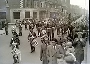
Donated by Hartlepool Museum ServiceThe camera would be about where the Central Library now stands looking along York Road. The bank is on the corner of Thornton St. Going north along the block is Heslop and Thompson, a bakery(possibly Kemp?) Bruce Moore, Find it Out and the church is York Road Methodist Church.
The photo is from the early 1950s.
More detail » Parade looking north along York Road
 Created by NDM
Donated by Hartlepool Museum Service
Created by NDM
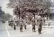
Donated by Hartlepool Museum ServiceTaken in the mid 1950s, York Road is behind the soldiers with The Parade in York Road on the left and Strathmore House in Stockton Road on the right.
More detail » Reids Florist at the corner of York Road and Colwyn Road
 Donated by Hartlepool Library Service
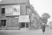
Reid's the Florist on the corner of York Road / Colwyn Road junction near the Burn Valley roundabout. The family also had a large nursery in the Thornhill Gardens area.
HHT&N 809
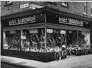
More detail » Robert Robinson 2
 Donated by Hartlepool Library Service
Part of the Library collection collection
Now Tilly Bailey and Irvine Solicitors, from 1933 and for many years Robert Robinson's cycle shop stood at Carlton Corner on the corner of York Road and Dalton Street. The shop advertises BSA, Triumph, Raleigh, Rudge and Coventry cycles which are names which have all but disappeared. In the windows can also be seen a vast range of accessories and Robert Robinson's was the place to go for puncture repair kits !
The image would be taken in the 1960s
HHT+N 977
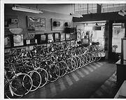
More detail » Robert Robinson 3
 Donated by Hartlepool Library Service
Part of the Library collection collection
The interior of Robert Robinson's York Road shop. Not only are cycles on sale but also televisions and radios. One advert is for an 'easy to fit car radio 22 gns' The shop was also crammed with cycles and many Hartlepool children of the 50s and 60s will have tried out their first bike at Robert Robinson's.
The photo will have been taken in the mid 1960s.
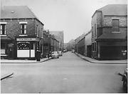
More detail » Roker Street then
 Created by West Hartlepool Council
Donated by Harry Taylor
Created by West Hartlepool Council
Donated by Harry TaylorRoker Street, Hartlepool, looking East from Dalton Street across York Road. Roker street is now part of the Town Centre and car parks.
The Coop bakery is on the left and Waldon Street in the distance.
The photo was from a photographic record of the Central Area of West Hartlepool prepared in 1955/6 at the request of the Town Planning and Redevelopment Committee 'in the hope that it will be of interest to future generations of West Hartlepool'
The record focuses on areas which were within the next ten years to be completely redeveloped following The Max Lock Plan. It was compiled by WL Taylor and photographs developed by Thomas Clarkson Chemist of Tower Street.
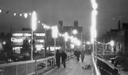
More detail » Shopping Centre Ramp 1976
 Created by northern daily mail
Donated by Hartlepool Museum Service
Created by northern daily mail
Donated by Hartlepool Museum ServiceDated 1976
Taken in December 1976 with Christmas lights adorning the Shopping Centre ramp.
At first glance, things look little changed, but the Central Library now stands on the left of the ramp and the Yorkshire Bank on the right.
More detail » Society of Friends Meeting House
 Donated by Douglas Ferriday
Part of the Hartlepool Library Service collection
Dated 1975
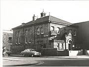
Taken in the 1970s, this building still exists with a new frontage and is now a shop in York Road. The side in Middleton Grange Lane has been rendered, the dovecote removed but the street sign also still remains.
H04033
More detail » Stockton Road
 Donated by Hartlepool Library Service
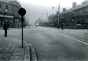
Junction of Stockton Road and York Road, Hartlepool, Burn Valley Gardens on the right.
More detail » Stockton Road then and now
 Created by Bill Stevenson
Donated by Hartlepool Library Service
Created by Bill Stevenson
Donated by Hartlepool Library ServiceStockton Road, Hartlepool at the juction with York Road
More detail » Thornton Street and York Road corner
 Created by NDM
Donated by Hartlepool Museum Service
Created by NDM
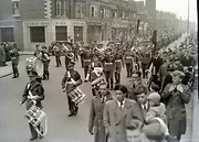
Donated by Hartlepool Museum ServiceParade in York Road in the mid 1950s showing the shops on the west side of York Road between Thornton Street and South Road. At the end of the block is York Road Methodist Church. Two branches of Bruce Moore can be seen.
More detail » Victoria Road - York Road junction now
 Donated by Harry Taylor
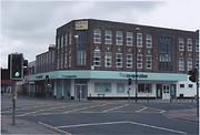
Victoria Road, York Road junction, Hartlepool now with the Coop Chemist on the corner.
More detail » Victoria Road - York Road junction then
 Donated by Harry Taylor
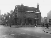
Victoria Road, York Road junction, Hartlepool. The building in the foreground was replaced by the Coop Chemist building in the 1950s.
More detail » Victoria Road York Road junction
 Created by NDM
Donated by Hartlepool Museum Service
Created by NDM
Donated by Hartlepool Museum ServiceDated 1971
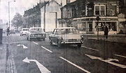
Taken in November 1971, the image shows the traffic moving towards the town from Victoria Road where it meets the lights at York Road.
What is of interest is the lovely Victorian terrace on the right which was demolished soon after the photo to make way for an austere and ugly modern block of shops which are there today. (See image Victoria Road 1988)
More detail » Victoria Road now
 Donated by Harry Taylor
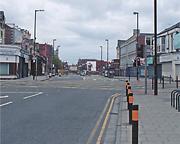
Victoria Road, Hartlepool at it's junction with York Road as it looks now.
More detail » Victoria Road then
 Donated by Harry Taylor
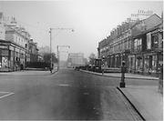
Victoria Road, Hartlepool at its junction with York Road with Binns Department Store in the background. THe upper floors of the buildings on the left are little changed although the front gardens have gone. Apart from the first building which is still retail, the others on the left are now wine bars.
Inexplicably, the council demolished the beautiful terrace of houses on the right and replaced them with an ugly modern terrace of shops. The shops at the near right remain.
This image is pre. April 1953 as the trolley bus lines were removed then.
More detail » Victoria Road, Hartlepool
 Donated by Hartlepool Library Service
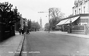
Postcard which states that this is York Road. It is actually Victoria Road looking at the York Road junction before the traffic light were installed. You can see St Pauls Church spire in the background.
More detail » York Road
 Donated by Hartlepool Library Service
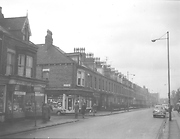
York Road, Hartlepool at the junction with Elliott Street. The shop on the far corner of Elliott Street was Pattison's the Chemist which also sold an extensive range of cameras, projectors and home photography developing equipment.
More detail » York Road
 Created by Bill Boagey
Donated by Hartlepool Museum Service
Created by Bill Boagey
Donated by Hartlepool Museum ServicePart of the Bill Boagey collection
A photo of York Road looking North when the street was a shopping area. Bruce Moore (radio/records), Hintons (grocers), Sparks Bakers and Jack Bearby, chemist, all in the frame.
More detail » York Road Houghton Street
 Part of the Library collection
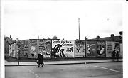
The image has been taken probably in the late 1950s from the traffic lights in Elwick Road looking towards York Road. Where the advertising hoardings are now is Shotton's Furniture Store.
In World War 2 following a bombing raid, 31 houses in Elwick Road and Houghton Street were demolished here.
In the background on the left is the tower of Stranton Club and the chimney is probably that of Durham Paper Mills.
The adverts are for Walls Ice Cream, Guiness, Players cigarettes, Double Maxim beer, Fairy, Trex and the Empire Theatre where the main act was The Merry Magpies.
More detail » York Road Bailey Street corner - 1
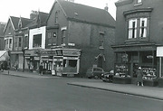
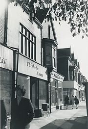
This undated photograph shows Ruell's jeweller and an un-named cafe.
More detail » York Road Bailey Street corner - 2
This shows changes since the first photograph in this series.
More detail » York Road Bailey Street corner - 3
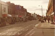
This was presumably taken at the same time as No. 2 in this series, but looking south. The former Ruell's shop has been altered and is to let.
More detail » York Road Shops 2
 Part of the Library collection collection
A further view of shops in York Road. Lamb's Jewellers is visible beside the well known clock and beyond that, the Yorkshire Bank appears to be under construction. The Central Library is possibly not built at this point although it is set back from the line of other buildings and could be there. Beyond that, the white side of Gales Garage on the corner of Villiers Street can be seen and this was demolished some years ago and replaced by a new LLoyds Bank building.
HHT&N 215
More detail » York Road United Methodist Free Church
 Donated by Hartlepool Museum Service
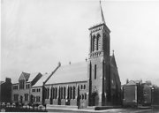
York Road United Free Methodist Church, Hartlepool at the junction with South Road. Building now demolished.
More detail » York Road and St George's Congregational Church
 Donated by Dougals Ferriday
Part of the Hartlepool Library Service collection
Dated 1973
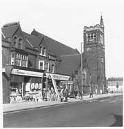
York Road in 1973, showing Liptons General Dealers, Scorers Ironmongers and St George's Congregational Church. Park Road junction is at the far right.
More detail » York Road c.1916
 Donated by Hartlepool Library Service
Part of the Hartlepool Library Service collection
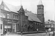
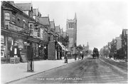
York Road, Hartlepool. In the centre of the picture is the neo-Gothic tower of St. George's Church, York Road.
HO4128
More detail » York Road from Victoria Road Junction
 Created by NDM
Donated by Hartlepool Museum Service
Created by NDM
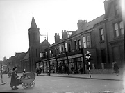
Donated by Hartlepool Museum ServiceThis image from the early 1950s has been taken from the traffic lights in Victoria Road. Nothing is really recognisable now. The house on the far right, North View was demolished and the large formerly Coop Chemist building replaced it, The shops to the left, apart from the two furthest left were demolished as the chemist's building was larger than the house it replaced.
The shops visible are Carr's Fashions, Jack Bearby and Spark's the Bakers. Bruce Moore's was later on the far end of the block, although not when this was taken, and has since had a number of food and drink uses.
The church on the other corner of South Road was York Road Methodist Church and this was replaced by a red brick block of shops, currently mainly charity shops and a pawnbroker.
More detail » York Road looking north
 Part of the Library collection
Dated 1988
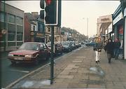
Taken in May 1988 looking north from the York Road/ Victoria Road crossroads, many of the businesses on the left are now greatly changed. The building Nickolodeon is now the Sicilliano Pizza takeaway shop. Previously it had been The Yorkshire Lassie opened in 1951. On the next block, all the shops and White's Tyre Company were Marco Polo Italian restaurant until recently. On the right, The Regal Bingo is currently Carlton Bingo and was the Essoldo cinema originally opened in 1936 under the name of The Regal and changing to The Essoldo in 1955.
HHT&N 212
More detail » York Road now
 Donated by Harry Taylor
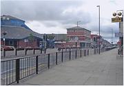
York Road now showing the Central Library on the left before the juction with Villiers Street.
More detail » York Road shops
 Part of the Library collection collection
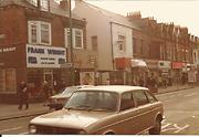
Probably taken in the late 1980s, the view is of much loved,familiar and long gone shops which were very much local businesses. Frank Wright's stationer,toy shop and bookseller is evident on the left. Next to it is Unity House which sold beautiful baby clothes and just past the walkway between the shops is Argosy shoe shop where many will remember having their feet carefully measured when they were children.
HHT+N 746
More detail » York Road then
 Created by West Hartlepool Council
Donated by Harry Taylor
Created by West Hartlepool Council
Donated by Harry TaylorPart of the Library collection collection
Dated 1956
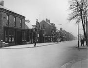
York Road, Hartlepool, taken from the junction of Thornton Street looking South. The Northerns Cinema, then Gales Garage can be seen on the corner of Villiers Street. Beyond that is Regents Buildings. On the right, St George's Church can just be seen.
The photo was from a photographic record of the Central Area of West Hartlepool prepared in 1955/6 at the request of the Town Planning and Redevelopment Committee 'in the hope that it will be of interest to future generations of West Hartlepool'
The record focuses on areas which were within the next ten years to be completely redeveloped following The Max Lock Plan. It was compiled by WL Taylor and photographs developed by Thomas Clarkson Chemist of Tower Street.
More detail » York Road then and now
 Created by Bill Stevenson
Donated by Hartlepool Library Service
Created by Bill Stevenson
Donated by Hartlepool Library ServiceYork Road, Hartlepool
More detail » York Road then and now
 Created by Bill Stevenson
Donated by Hartlepool Library Service
Created by Bill Stevenson
Donated by Hartlepool Library ServiceYork Road, Hartlepool at the junction of South Road. Original picture showing Jackson & Dunn Ltd
More detail » York Road then and now
 Created by Bill Stevenson
Donated by Hartlepool Library Service
Created by Bill Stevenson
Donated by Hartlepool Library ServiceYork Road, Hartlepool
More detail » York Road towards Elwick Road
 Part of the Library collection collection
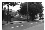
For many years this site had advertising hoardings. Fairly recently retail units with flats above have been built.
HHT&N 195
More detail » York Road, Victoria Road junction
 Created by Bill Boagey
Donated by Hartlepool Museum Service
Created by Bill Boagey
Donated by Hartlepool Museum ServicePart of the Bill Boagey collection
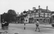
Martins Bank on the corner of York Road and Victoria Road. Old style pram and traffic lights. Picture very blurred unfortunately.
More detail » York Road/ Gill Street 2
 Created by Bill Henderson
Donated by Bill Henderson
Created by Bill Henderson
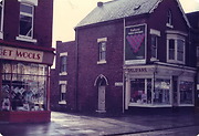
Donated by Bill HendersonCorner of York Road and Gill Street in the 1980s.
More detail » York Road/ Thornton Street
 Part of the Hartlepool Museum Service collection
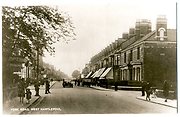
The road off to the left and right is Thornton Street. The left side still exists and the shops are still there wheras the large house on the right is demolished and the Yorkshire Bank, Shopping Centre ramp and Central Library are approximately where the east part of Thornton Street ran down to meet Swainson Street.
More detail » York Road/Gill Street
 Created by Bill Henderson
Donated by Bill Henderson
Created by Bill Henderson
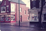
Donated by Bill HendersonTaken in the 1980s showing Ada's Wools and Delifare on the corners of Gill Street.
More detail » York Road/Victoria Road
 Created by West Hartlepool Council
Part of the Library collection
Created by West Hartlepool Council
Part of the Library collectionDated 1956
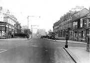
Looking east across York Road, Binns in the right distance and behind the trees the Grand Hotel in the left distance. The terrace of houses on the right are demolished although the shops on the right exist still. On the left, to the right of the shop is the house which would become The Grange (later Loons) pub and then a car showroom and the gas showrooms all of which are now wine bars.
The traffic lights at this junction were there then and one of just a few sets in the town in 1956.
The photo was from a photographic record of the Central Area of West Hartlepool prepared in 1955/6 at the request of the Town Planning and Redevelopment Committee 'in the hope that it will be of interest to future generations of West Hartlepool'
The record focuses on areas which were within the next ten years to be completely redeveloped following The Max Lock Plan. It was compiled by WL Taylor and photographs developed by Thomas Clarkson Chemist of Tower Street.
More detail »


