Hartlepool Sports & Leisure
Hartlepool Transport
A Potted History Of Hartlepool
Hartlepool Trade & Industry
Hartlepool Health & Education
Hartlepool People
Hartlepool Places
Hartlepool at War
Hartlepool Ships & Shipping

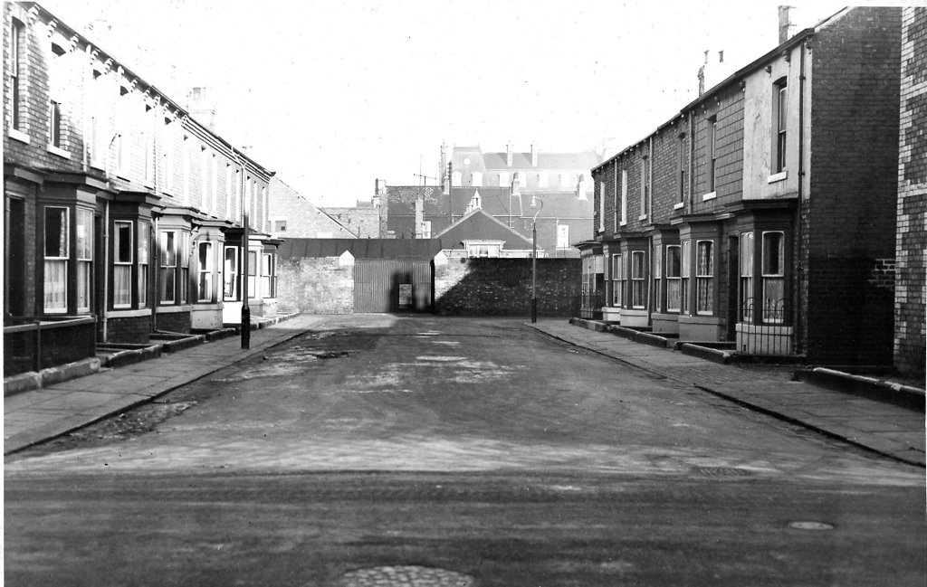
Peckett Street
What we know about this image :
Looking north from Thornton Street, part of the Territorial Army HQ and the Grand Hotel across Victory Square can be seen in the distance.
This is typical of a street which was not 'blighted housing ' to quote Max Lock, but was demolished to make way for the development of the central area.
The photo was from a photographic record of the Central Area of West Hartlepool prepared in 1955/6 at the request of the Town Planning and Redevelopment Committee 'in the hope that it will be of interest to future generations of West Hartlepool'
The record focuses on areas which were within the next ten years to be completely redeveloped following The Max Lock Plan. It was compiled by WL Taylor and photographs developed by Thomas Clarkson Chemist of Tower Street.
Date (of image) : 1956
Creator : West Hartlepool Council
Part of the "Hartlepool Library Collection" collection
Location
Related items :
 Peckett Street